


Where Waters Converse: Tracing the Pozhis of Alappuzha’s Coastal Edge
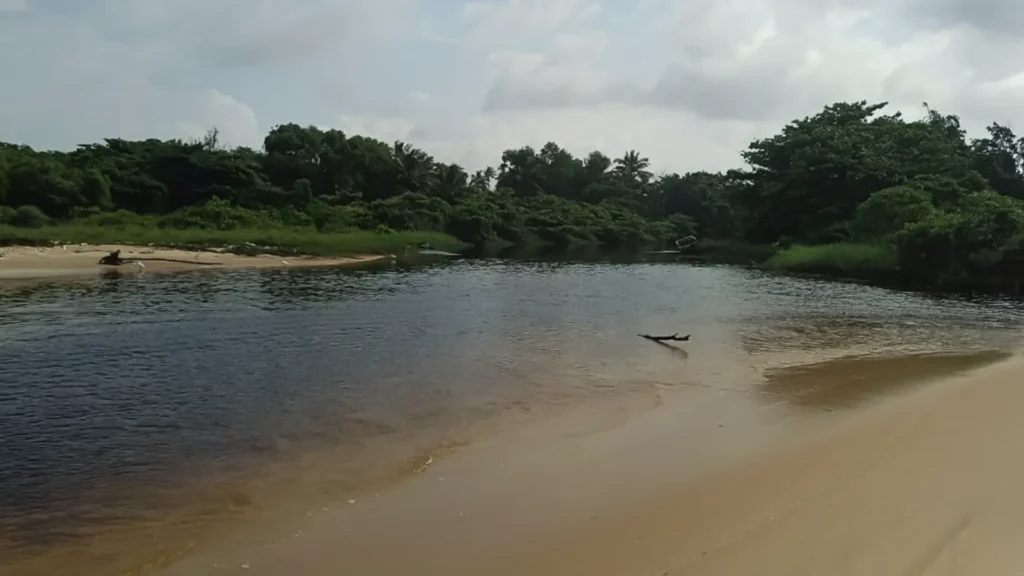
Along the coast of Alappuzha, there are water passages that weave their way to the sea, breathing with the tides and sustaining the shore’s vitality. These are not just water channels; they are living arteries that connect backwaters, canals, and the Arabian Sea. These openings are known as ‘pozhis’ (tidal creeks). Unlike the major estuarine mouths, many of these pozhis are not directly connected to the larger backwater system. Along the coast of Alappuzha, they often branch off as narrow canals, trickle through low-lying land, or simply fade out before reaching any major waterbody. Their shape and presence shift with the seasons, sometimes opening wide and closing when sandbars are built up by waves and coastal winds. When they open, they act as natural relief channels; when they close, the landscape becomes still, and water pools quietly in the lowlands.
Recently, our team spent weeks tracing these often-forgotten systems along Alappuzha’s coast. What began as a field mapping exercise soon turned into a lesson on how nature’s infrastructure quietly holds together the balance between floods, farming, and fisheries, and how governance frameworks are struggling to keep up.
Pozhis: The Unsung Drainage Engineers
We often think of pozhis merely as tidal inlets and outlets because their most visible function is the exchange of seawater with the inland during tides. To the casual observer, this ebb and flow appears to define their purpose. But what we miss is that they play a far greater role, acting as vital conduits that drain inland waters from lakes and backwaters into the sea, maintaining a delicate balance between land and tide.
Every year, during the southwest monsoon, when nearly 60% of Kerala’s annual rainfall arrives, pozhi channels carry floodwaters safely out to sea. The Vembanad Lake system, spanning three districts, processes over 16,000 million cubic metres of water every year. Even though Alappuzha is blessed with the beauty of its lakes and backwaters, it carries a quiet paradox as a central part of the land lies below sea level, where vast paddy fields survive only through constant drainage. Here, Pozhis act as relief valves, protecting dense settlements and low-lying farmland.
What the Field Told Us
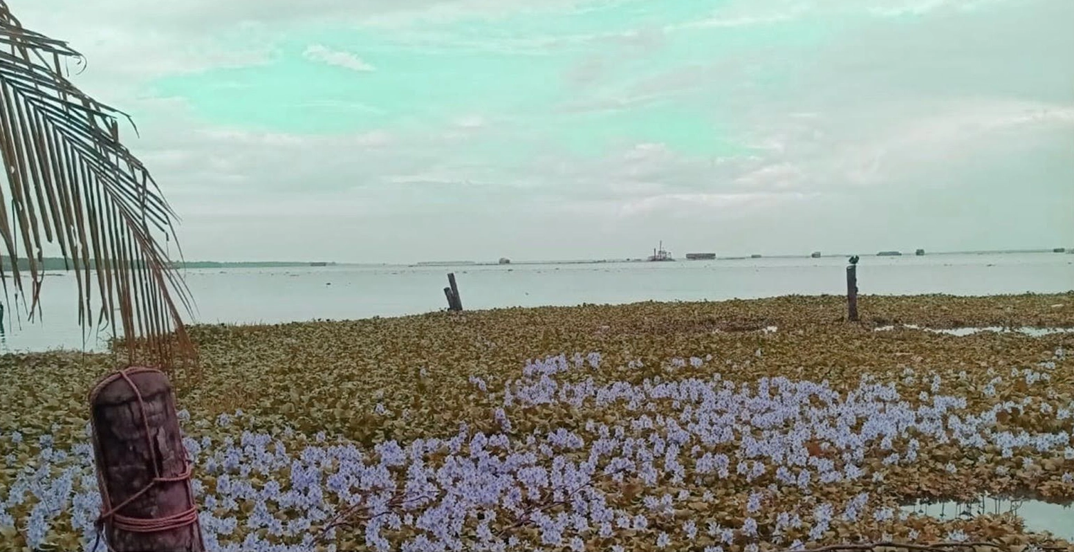
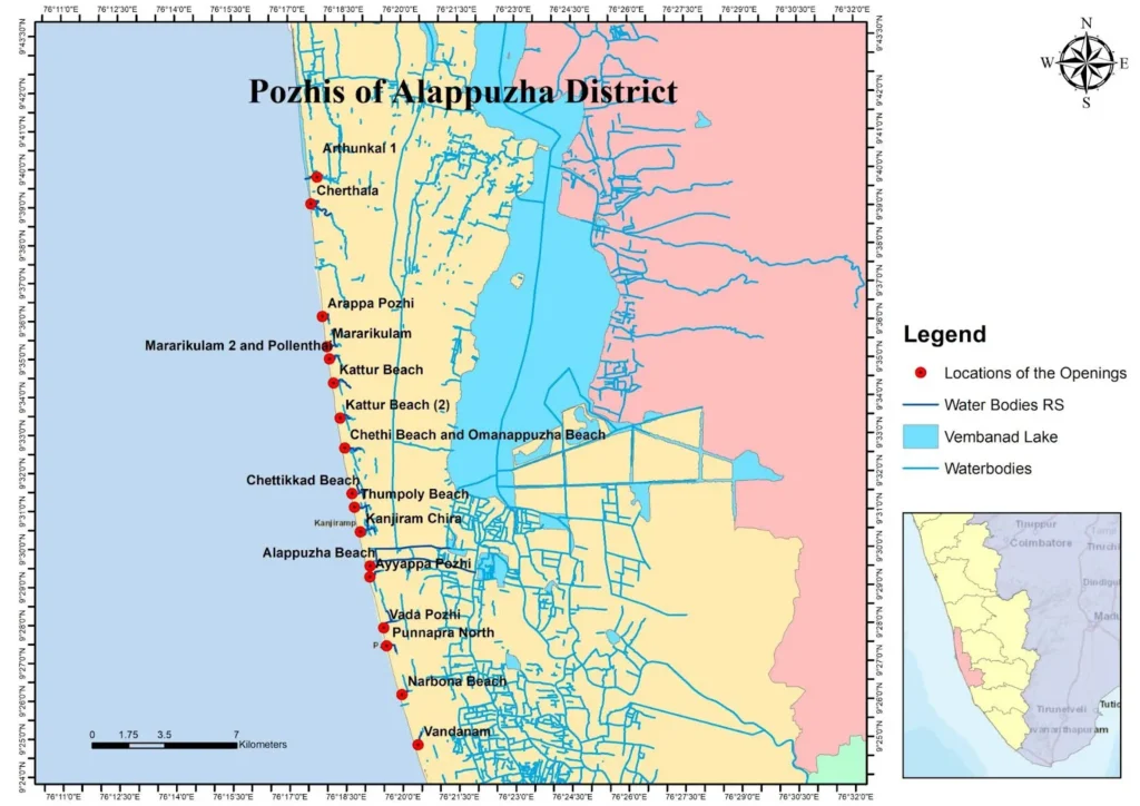
We mapped 17 pozhis and their connecting channels across Alappuzha’s 75-kilometre coastline, walking and mapping sites from Arthunkal to Vandanam. Each location told its own version of the same story: how the meeting of freshwater and seawater shapes the very character of Alappuzha’s coast. The study traced the subtle but crucial links between land use, tidal flow, sediment transport, and the health of these fragile coastal systems. Observations showcased how sandbars form seasonally and are breached during monsoon surges, and how salinity gradients shift inland during high tides. We observed that Pozhis vary in size and depth. Vada Pozhi and Arappa Pozhi were massive, measuring 10 to 12 metres, 1 metre and 4 metres deep, and carrying water from large catchments. Others, such as Muthala pozhi and Ayyappa pozhi, were shallow and narrower, measuring about 3-5 metres.
Local communities have always known their hydrological rhythms. They speak of veliyettam (inflow) and veliyirakkam (outflow), natural cycles that decide when the sea should open or close.
Tsunami-Induced Transformations in Pozhi
The 2004 tsunami reshaped many of these channels. Many of the pozhis along the Alappuzha coast have undergone significant morphological changes following the 2004 tsunami. The sudden influx of waves caused erosion along the coastal margins, widening several pozhi mouths beyond their natural limits. Post-tsunami, several pozhis have retained these widened channels, altering the coastal-inland hydrodynamic interactions.
Encroached by Progress: The Silent Shrinking of the Pozhis
With the spread of urbanisation, Alappuzha’s delicate balance between land and water is being steadily undone. The natural drainage paths that once carried excess rainwater to the sea now find themselves hemmed in by commercial and residential buildings, roads, and resorts. Our field team’s visit to Vazhakkoottam Pozhi revealed just that. New construction walls have been raised right across what was once a living waterway that historically served as a primary tidal outlet for stormwater and backflow regulation. These physical barriers have disrupted hydraulic connectivity between the inland water bodies and the coast, severely reducing drainage efficiency during peak rainfall events.
Today, when floodwaters rise, the explanations come easily: unprecedented rainfall or climate change. Yet, much of this flooding is a consequence of our own neglect. We’ve built over the very structures that once protected us. What we call natural disasters are, in many cases, the outcomes of unplanned growth and planning blindness, a slow, self-inflicted erosion of our environmental intelligence.
Human Management
Seasonal sandbar formation, siltation, and vegetation overgrowth make human management indispensable. Municipal authorities reopen sandbars that form at the mouths of the pozhis to restore flow and prevent flooding. It’s a reactive ritual, a temporary fix that repeats year after year. These efforts reflect community spirit, yet the deeper causes of flow obstruction remain unaddressed, unchanged over time, revealing a larger pattern of institutional helplessness.
Widening the lens made it clearer: sedimentation from the Western Ghats is slowly filling the Vembanad Lake, reducing its storage capacity. That, in turn, makes coastal drainage harder. But while the cause lies upstream, the consequences hit downstream. Unfortunately, the governance doesn’t connect these dots. No long-term policies are guiding the protection of these Pozhis from encroachments and when or how to open them. Planning for drainage has become crisis management, not a system, just a scramble.
Inoculum or diluted cow dung is sprayed over the waste daily to maintain microbial activity, while dried leaves serve as an intermediate covering layer for the newly added waste. This method helps in maintaining the ideal inside temperature of the compost bin, which can reach 60-65 degrees Celsius. This high temperature reduces the formation of worms and minimises odor, making the composting process more manageable. After 45 days, the compost can be used as fertilizer. If any decomposition issues arise, coir pith can be used as a conditioner to resolve them. The maximum capacity of a bin is 1000 kg, and the dried compost, after completing a 90-day cycle, can be supplied as biofertilizer. Only after the first bin reaches its full capacity can the second bin be utilised, ensuring a continuous composting process.
The liner structure of the bin improves air circulation, and the inner side is covered with a net to prevent animal attacks. Total ten hopper bottom bins are connected to a leachate collection tank via a pipe system, which effectively removes the leachate produced by the waste. Abortion of the connection pipe extended in the bin 60 cm upward. This comprehensive approach ensures efficient and sustainable composting, contributing significantly to waste management efforts.
Preserving the Rhythm of Backwaters
Our fieldwork makes one point unmistakably clear: if Kerala wants resilient coasts, pozhi systems must be seen not as leftovers of nature but as core public infrastructure.
The pozhis of Alappuzha play a crucial role in maintaining the hydrological balance of the Vembanad Wetland Complex by enabling both tidal flushing and freshwater drainage. Even though the tidal flushing role of the pozhi and the associated sandbar formations at the mouth of it in the sea shore are taken into account by the authorities, their freshwater drainage function is often overlooked. Increased construction activities, sedimentation, vegetation overgrowth and reduced water exchange have weakened their natural functioning. Effective planning requires further detailed scientific mapping of pozhi pathways, identification of seasonal and physical obstructions, and regular monitoring of tidal and flow dynamics. Such systematic planning can guide targeted interventions such as desilting, dredging, and vegetation management, ensuring that pozhis remain open, connected, and able to manage floodwaters efficiently. Regulatory and planning measures are needed to protect these sensitive waterways from further human encroachment.
Sustaining the pozhis demands a coordinated governance framework that bridges institutional and community roles. At present, management is largely reactive, relying on short-term measures and local resource availability. Establishing clear protocols and long-term strategies for the protection and maintenance of pozhi, supported by interdepartmental collaboration and community participation, can transform these efforts into a consistent management system.
Ultimately, the pozhis represent the delicate interplay between land, water, and human stewardship. With thoughtful scientific management, community participation, and regular maintenance, these quiet waterways can continue to sustain both the wetlands and Alappuzha’s cultural identity. Protecting them is not only an environmental requirement but also a commitment to the resilience and well-being of the communities that have thrived along these shores for generations.
Authors

Harsha PR
Project Co-ordinator Vembanad Project Cell